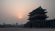
【新唐人2014年04月03日訊】在德國總理贈送中國歷史地圖的同時,菲律賓漁船日前突破中國海警船的封鎖,在有爭議的島礁,為廢棄軍艦提供人員換防和物資補給,菲律賓還向海牙國際法庭遞交訴狀,指控中國在南中國海劃設的國界線違反海洋法公約。中國歷史上11段線的國界線,何時變成了9段?是誰出賣了中國的土地?我們一起看看。
菲律賓3月28號突破中國海警船的封鎖,到有主權爭議的仁愛礁,為廢棄軍艦提供人員換防和物資補給,並在29號正式向海牙國際仲裁法庭,提交了長達4000頁的訴狀,指控北京在南中國海的「九段線」劃界,違反海洋法公約。
據歷史資料記載,第二次世界大戰結束後,「中華民國」作為戰勝國,國民政府根據《開羅宣言》和《波茨坦公告》組織軍隊,對日本曾經侵佔的南海諸島進行接收,經過實地勘察、測量後,1947年完成了對南海諸島的命名工作。1948年對外公布標有11段「斷續國界線」的《南海諸島位置圖》,在以後幾十年的國際社會間沒有人提出異議。
1953年中共為了拉攏越南共產小兄弟,對原有的11段的「斷續國界線」進行調整,將北部灣兩段去掉,造成11段線變成「九段線」。
1982年,聯合國設立《聯合國海洋法公約》,規定離陸地12海浬處為本國領土,對東海諸島和南海諸島的爭議劃出了明確界限,而這些界限和「中華民國」劃定的海洋界限嚴重衝突,中共參加了海洋法會議,並在《海洋法》上簽字承認。
美國中文雜誌《中國事務》總編輯伍凡:「那麼現在要按哪一條呢,11條線中華民國是根據歷史上的資料,再加上日本投降後這些島都要歸還出來,中華民國去接收了,中華民國移到台灣以後,中共也接收了,中共相當時期不管南海,給菲律賓、越南佔領了,所以矛盾就出來了,如果你要根據《海洋法》,你要放棄9條。」
對於菲律賓的上訴,中共外交部發言人洪磊說,中方已多次表明不接受菲方就中、菲南海爭端,提起的國際仲裁。對於島礁主權爭議和海域劃界問題,中方堅持與有關當事國直接談判解決爭議。
旅美時政評論專欄作家胡平:「他嘴上必須堅持不放棄,但是實際上他知道這個恐怕站不住腳,而且自己的力量也有一定的限度,所以在處理具體問題的時候,還是有一定的靈活性和妥協,但嘴上還是要那麼堅持。」
伍凡:「共產黨,如果它把它放棄的話,那它就是個賣國賊,因為你當政你要守著家產,你不守家產,你就是敗家子,我反共比誰都堅決,我是個民族主義者,我要保護中國的財產。」
在最近幾天,中共國家主席習近平訪問德國期間,德國總理梅克爾送上了一張繪於1735年的中國地圖,這張地圖是當年德國的傳教士和法國的傳教士畫出來的,其中中國的版圖也包括南海。
這張地圖傳出後,讓接受中共教育出來的民眾大吃一驚。民眾把這張地圖和「中華民國」地圖,以及現在的中國地圖做對比,看看中共奪權後使中國失去了多少土地。
旅澳歷史專家李元華:「包括外蒙古,包括跟蘇聯交界的,還有南亞一些地區那都是中共去出賣的,這個出賣實際上49年後就在做,最辱國的就是89六四之後江澤民上臺,把相當於幾十個台灣島這麼大的領土給了俄國。」
1979年鄧小平為奪取軍權,發動所謂的「對越自衛反擊戰」,據民間公布的數字,當時犧牲了十幾萬中國軍人,而20年後的1999年,當年激戰的邊境地區雲南老山和廣西法卡山,由前中共總書記江澤民簽字劃歸越南,從此中國陣亡將士屍骨永遠埋葬在異國他鄉。
採訪編輯/劉惠 後製/陳建銘
Philippines vs. China – Sparks Fly Over Disputed Water
When Xi Jinping received an historical map from the German
Chancellor,
a Philippine government vessel maneuvered around the
disputed reef in the South China Sea delivering
provisions to Philippine troops stationed in the area.
The Philippines filed a case against China on Sunday at an
arbitration tribunal in The Hague,
indicating that Beijing violated the U.N. Convention on the
Law of the Sea (UNCLOS).
The nine-dotted line, covering the sovereignty claimed by the
CCP in the South China Sea used to be eleven-dotted-lines.
Who altered it? Who betrayed the territory of the
Chinese people?
Let´s take a look.
On March 28, the Philippine vessel evaded two Chinese
coastguard ships trying to block its path to deliver food, water
and fresh troops to a military outpost on the shoal, Ren’ai reef.
On March 29, the Manila government also submitted to the
tribunal evidence of 4,000 pages
accusing Beijing of breaching the UNCLOS with its
nine-dotted line territory claim in the South China Sea.
According to historical records, after World War II,
the Republic of China as the victor country,
the then Nationalist Government retrieved the South China
Sea islands from Japan and conducted field investigations
and measurements.
In 1947, naming of the islands was completed.
In 1948, a map of the South China Sea and Islands labeled
with eleven-dotted lines as the demarcation line was published.
No objection was raised even decades after the map was
published.
In order to win over the Communist Vietnam, the CCP deleted
two dotted lines in the northern gulf in 1953.
The eleven-dotted lines became nine-dotted lines.
In 1982, the United Nations Convention on the Law of the Sea
regulated that every State has the right to establish the breadth
of its territorial sea up to a limit not exceeding 12 nautical miles.
It was a clear boundary violation of the sovereignty of the East
China Sea and the South China Sea and the Islands of the Republic
of China.
However The CCP participated in the Convention,
and signed and recognized the agreement.
Chris Wu, China Affairs magazine Editor-in-Chief:
“Which one to follow? The eleven dotted lines was an historical
presentation of the territory, included the islands occupied by
Japan during WWII.
After Japan was defeated, they were returned to the
Republic of China, and later to the Communist regime.
But, for a long time the CCP cared nothing for those
islands which were then occupied by the Philippines and
Vietnam. But,now the conflict arises.
If you want to follow the UNCLOS, you´ll have to give
up on the nine-dotted line."
Chinese Foreign Ministry spokesman Hong Lei responded that
China would not accept arbitration,
and that China was committed to managing and resolving
relevant issues through dialogue.
Hu Ping, US-based columnist and commentator: “The CCP
will insist on not giving up,
but know well that it is probably untenable, because their
force is limited.
There´ll be some flexibility and compromises, but still being
insistent on the talks."
Chris Wu: “If the Communist Party abandons it, then they are
the traitors.
They become the black sheep for giving up on their own territory.
I am strongly anti-communist. I am a nationalist and I want
to protect China’s assets."
On March 28, the German Chancellor, Angela Merkel,
presented the visiting Chinese President, Xi Jinping, with a map
of China from 1735 drawn by the German missionaries and
French missionaries.
The map showed China’s 13.5 million square kilometers of
territory, including the South China Sea.
The publicized map was a surprise to the people in China after
decades of rule by the CCP.
People were shocked to discover the vast loss of Chinese
territory following the rule of the CCP
by comparing the 1735 map with that of the Republic of China
map, and the current one under the CCP rule.
Li Yuanhua, historian: “The CCP has betrayed China by
giving up on Mongolia, the junction with the Soviet Union,
and areas of South Asia.
This betrayal has started since 1949.
1989 was the most blatant when Jiang Zemin came to power.
He gave up territory equivalent of dozens of Taiwans to Russia."
In 1979 Deng Xiaoping launched the Sino-Vietnamese War to
seize military power.
Civil figures revealed hundreds of thousands of Chinese
soldiers were killed in this border war.
However, 20 years later, the border areas of battle such as
Laosan of Yunnan Province and Faka Hill of Guangxi Province
were given to Vietnam by Jiang Zemin in 1999.
Since then, those who died for the border war were forever
buried in a foreign territory.
Interview/Liu Hui Post-Production/Chen Jianming